 Help & Support
 SEARCH
NASA's interactive Martian mosaic now available for all users

SHARE IT
It is unlikely that anyone would not be excited by NASA's explorations on Mars. The US space agency is set not only to return samples from the red planet back to Earth, but promises to share more and more data with the public in greater detail.
To that end, NASA has created a new mosaic using more than 110,000 photos of the Martian surface and data collected over the years by the Mars Reconnaissance Orbiter, which was analyzed by researchers at Caltech's Bruce Murray Laboratory for Planetary Visualization.
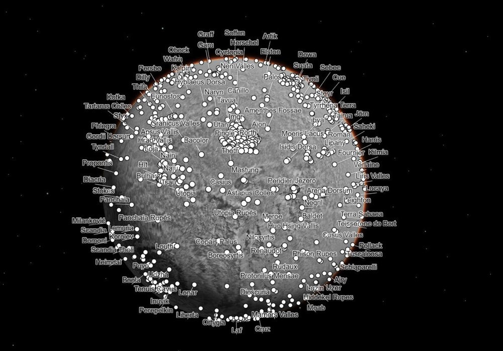
The mosaic image has a total size of 5.7 trillion pixels and, if it were possible to print it, would take up the equivalent of the Rose Bowl Stadium in California. Users visiting Murray Lab's dedicated website will find navigation tools on this map and detailed information on each point of interest that has been thoroughly explored by NASA's various rovers.
For example, you can start at the famous Jezero Crater where the Perseverance rover is moving, looking for traces of ancient microbial life, and even follow the entire path it has taken over the years on the surface of Mars. Note that the Mars Reconnaissance Orbiter continues to take pictures of the planet's surface and has managed to cover almost every inch of it so far.
As Jay Dickson, the project lead at Murray Lab, stated, their goal is to create a tool that users of any age can use with characteristic ease, whether they are young students or elderly.
MORE NEWS FOR YOU


